Welcome to 100% Solutions
Innovation Beyond Boundaries
Search
Land Survey
Land Survey defines land boundaries and guides safe, legal construction.
Overview

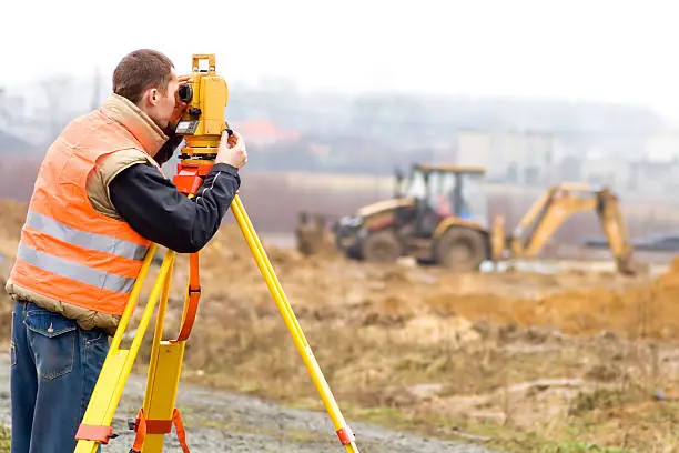
A land survey is the science and art of precisely measuring land to determine boundaries, contours, structures, and physical features. It translates the physical world into data, enabling architects, engineers, and homeowners to understand the dimensions and shape of the land they are working with.
The output of a land survey is typically a survey map or report—a legal document that defines property lines, highlights terrain features, and identifies any obstacles or utilities underground or overhead. These surveys are conducted by trained professionals called licensed land surveyors who use tools like total stations, GPS, drones, and Geographic Information Systems (GIS) to record exact measurements.
Why Is Land Surveying Crucial in House Construction?
When planning to build a house, most people think first about design, materials, or budget. But land surveying is the first, non-negotiable step before any other action. Here's why:
1. Legal Property Boundaries and Ownership
Before you build, you need to know exactly where your land begins and ends. A land survey determines the legal boundaries of your plot. This ensures that:
-
You don’t accidentally build on a neighbor’s land (which can lead to lawsuits or demolition).
-
You follow local zoning and setback rules (distance from property lines).
-
Your home, fence, or driveway is located entirely within your property.
Especially in areas with irregular land parcels or unclear title deeds, boundary disputes are common. A survey is your strongest legal safeguard.
2. Safe and Suitable Foundation Planning
Not all land is equally suited for building. A land survey provides topographic information—such as slopes, elevation changes, soil type, and drainage patterns. This helps engineers and architects:
-
Decide where to place the house for the strongest foundation.
-
Design a building that works with the natural grade of the land.
-
Avoid flood-prone zones, unstable soil, or excessive excavation costs.
In hilly, coastal, or clay-rich regions, one wrong assumption about the land’s surface can cause cracks in walls, uneven floors, or future structural failure.
3. Utility Lines and Obstructions
Surveyors often identify existing underground utilities, water pipelines, electrical cables, or sewage systems that could interfere with construction. Accidentally digging into a water line or power cable can not only delay your project but also result in hefty fines or injuries.
Knowing where these lines are helps in:
-
Planning safe trenching and foundation work.
-
Connecting your home efficiently to water, electricity, and sewer systems.
-
Avoiding costly rerouting or damage to public utilities.
4. Planning Access and Orientation
With the help of a survey, you can decide:
-
Which direction your house should face (for sunlight, wind flow, or privacy).
-
Where the driveway or entry gate should be.
-
How to align your garden, pool, or backyard to best utilize available space.
In urban plots or narrow lots, a survey can help maximize usable space and avoid awkward layouts.
5. Preventing Future Disputes and Legal Issues
Even if you believe you know your land well, official surveys often reveal hidden easements (legal rights for others to use part of your land), overlapping fences, or encroachments. Resolving these before construction starts can save years of legal trouble.
Additionally, if you plan to sell the house later, a verified land survey will be required during the transaction. Having this ready upfront increases your property’s value and legal clarity.
6. Complying with Local Building Codes and Permits
Most municipalities and local governing bodies require a land survey before issuing a building permit. The survey proves that:
-
The structure will meet zoning codes.
-
The planned building fits within allowable coverage and height limits.
-
There is no violation of heritage, greenbelt, or public right-of-way areas.
Starting construction without a survey can lead to fines, stop-work orders, or even demolition by authorities.
7. Supporting Accurate Design and Architecture
Architects rely heavily on land surveys to design structures that match the plot’s shape, orientation, and slope. Even a difference of a few feet can change:
-
The placement of rooms, doors, and windows.
-
The feasibility of basements or garages.
-
Rainwater harvesting or solar panel installation planning.
A precise survey helps translate creative ideas into structurally sound realities.
8. Cost Efficiency and Time Management
Skipping a land survey may appear to save money initially, but the long-term risks can cost much more:
-
Correcting a wrongly built wall or boundary fence.
-
Re-applying for permits.
-
Dealing with unhappy neighbors or lawsuits.
A land survey gives clarity from the start, reduces chances of rework, and keeps your construction timeline and budget on track.